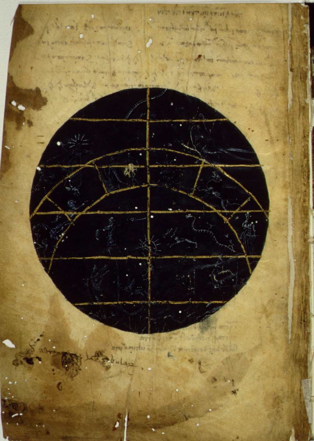
Ptolemy's "Handy Tables," intended for practical computation, were edited by Theon of Alexandria in the fourth century A.D. and became, with various modifications, the basis of later astronomical tables in Greek, Arabic, and Latin. The "Handy Tables" allow the calculation of solar, lunar, and planetary positions and eclipses of the sun and moon far more rapidly than the tables included in the "Almagest." This early and elegant uncial manuscript is well-known for its illumination, which appears to descend from a prototype in late antiquity as can clearly be seen in this map of the constellations, drawn elegantly in white against the dark blue of the night sky, showing the northern part of the zodiac.
Vat. gr. 1291 fol. 2 verso math12a NS.06
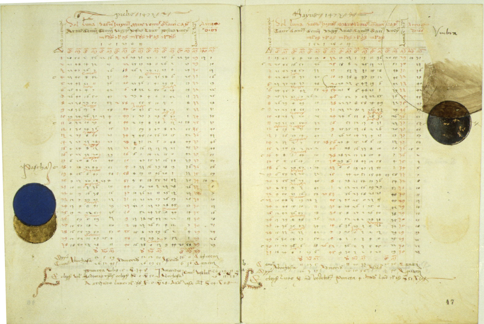
By the fifteenth century it had become common to compute annual ephemerides or almanacs giving daily positions of the sun, moon, and planets (for the casting of horoscopes) and eclipses of the sun and moon. Most were utilitarian but this uncommonly beautiful example, computed for the years 1466 to 1484, was prepared for Paul II by Nicholas Germanus, best known for his maps for Ptolemy's "Geography." The entries for the months of April and May of 1473, shown here, illustrate in the margins a partial solar eclipse on April 26 and a partial lunar eclipse on May 11.
Vat. lat. 3107 fols. 46 verso - 47 recto math13 NS.12
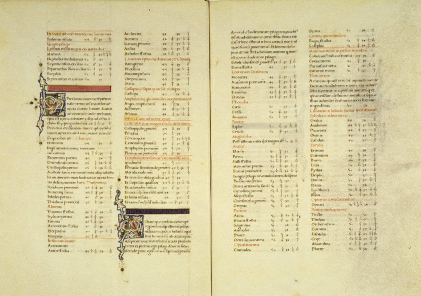
The text of Ptolemy's "Geography" was translated into Latin by 1406-09 by Jacopo Angeli da Scarperia and dedicated successively to Popes Gregory XII and Alexander V. Maps based on this translation followed independently within less than twenty years. By the middle of the century, increasingly opulent manuscripts of the "Geography," mostly from Florence, had become fashionable as conspicuous displays of wealth; and travellers and explorers as well as scholars read them. The pages displayed here, from a splendid pair of related manuscripts of text and maps, shows the coordinates, longitude and latitude, for locations in Greece.
Vat. lat. 3810 fols. 31 verso - 32 recto math14 NS.50
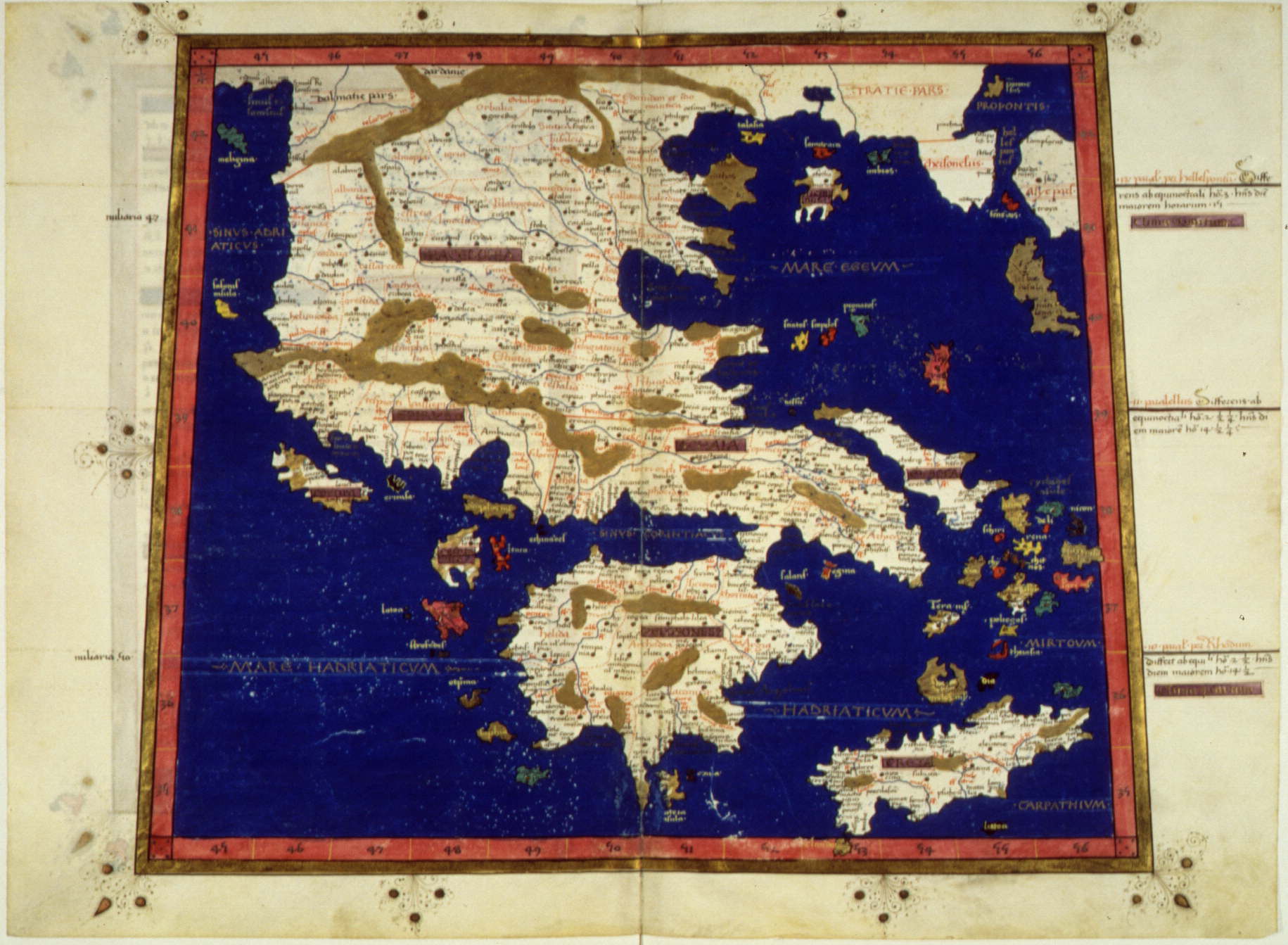
This map of Greece and the Aegean, very rich in detail and elegant in execution, corresponds to the coordinates in the preceding manuscript [Vat. lat. 3810]. The trapezoidal projection, reducing the distortion of longitudinal distances in a rectangular projection by having the meridians converge toward the pole, was the invention of Nicholas Germanus, who dedicated editions of the "Geography" to Borso d'Este of Ferrara and Pope Paul II. Nicholas personally supervised the preparation of a number of fine copies, perhaps this one among them, and his maps and projections continued to appear in the most important of the early printed editions.
Vat. lat. 3811 fols. 29 verso - 30 recto math15 NS.51 math11b fols. 146 verso - 147 recto